Uganda Map
Uganda MapA Uganda geography map and surrounding countries serving as a satellite map of Uganda together with a topographical map and a map of Uganda Lakes and Rivers. Uganda's position as a landlocked country in the Great Lakes region of East Africa is the first striking feature on its map. It shares extensive borders with five neighbouring countries, each contributing to its geopolitical significance. To the east lies Kenya, a crucial transit route for its imports and exports. To the south, Tanzania and Rwanda form its southern flank, with Rwanda sharing a mountainous and densely populated border. The Democratic Republic of Congo (DRC) borders Uganda to the west, characterised by the Western Rift Valley and shared mountain ranges. Finally, to the north, South Sudan delineates a border marked by dry savannas and historically nomadic communities.
The most dominant and defining feature on a map of Uganda is undoubtedly its abundant bodies of water, which are not merely geographical markers but the very lifeblood of the nation. A. The Great Lakes and the Source of the Nile: At the heart of Uganda's map lies Lake Victoria, the second-largest freshwater lake in the world by surface area. Its sheer size dominates the southeastern portion of the country, influencing climate, supporting vast fishing industries, and serving as a vital transport route. More importantly, Lake Victoria is recognised as the principal source of the River Nile, the world's longest river. The point where the Victoria Nile begins its journey northward, cascading over the Ripon Falls (now submerged by the Owen Falls Dam), is clearly visible on maps near the city of Jinja. The Nile then flows through Lake Kyoga in central Uganda, a wide, shallow, and often swampy lake, before entering Lake Albert on the western border, and finally continuing its journey north towards Sudan and Egypt.
Beyond Victoria, Uganda is home to several other significant lakes, primarily concentrated in the western Rift Valley. These include Lake Albert, a long, narrow lake forming part of the border with the DRC; Lake Edward and Lake George, connected by the Kazinga Channel, which are critical components of Queen Elizabeth National Park; and the smaller crater lakes scattered across the west. This extensive network of lakes and rivers profoundly impacts Uganda's climate, biodiversity, agriculture, and hydroelectric power generation. B. Topographical Diversity: Mountains, Plateaus, and Plains: Uganda's map reveals a varied topography, ranging from towering peaks to vast plains. To the southwest, straddling the border with the DRC, are the Rwenzori Mountains, famously known as the "Mountains of the Moon." These glaciated peaks, including Margherita Peak (Uganda's highest point at 5,109 meters), are snow-capped year-round, a unique sight on the Equator. Their rugged relief and distinct ecosystems are clearly delineated on detailed maps, highlighting their importance for biodiversity and as a source of rivers. To the east, near the Kenyan border, rises Mount Elgon, an extinct shield volcano with one of the world's largest volcanic calderas. Its fertile volcanic soils support a dense population and extensive coffee cultivation, characteristics implied by the agricultural intensity visible on land-use maps. The rest of Uganda is largely dominated by a vast central plateau, gently sloping downwards from south to north. This plateau, dotted with inselbergs (isolated rock hills), forms the agricultural backbone of the country, largely covered by savanna grasslands and scattered woodlands, transitioning to more arid conditions in the northern regions. The western part of the country is also marked by the Western Rift Valley, whose escarpments and associated lakes (Albert, Edward) are prominent geographical features on the map. |
 The nature of these borders is varied and telling. While some are drawn along straight colonial lines, many follow natural features, creating a dynamic interplay between human demarcation and natural boundaries. Lake Victoria, the largest lake in Africa, forms a significant portion of Uganda's southern and southeastern border with Tanzania and Kenya, highlighting the shared regional resource. The Rwenzori Mountains define a segment of the border with the DRC, while others are less distinct, crossing plains and rivers. This landlocked status inherently shapes Uganda's economic strategies, particularly its reliance on regional trade routes and diplomatic relations with its neighbours.
Uganda Map | Uganda Map | Uganda Map | Uganda Map |
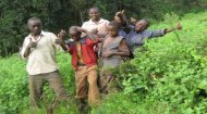
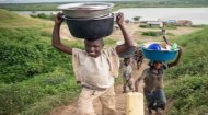

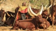
A profile of Uganda in pictures and images captured on video showing the finest of the country.
More >
|
|


|
The map of Uganda also provides a comprehensive overview of its administrative divisions and human settlements, reflecting the nation's governance structure and population distribution. A. Administrative Divisions: Uganda is divided into four main administrative regions: Central, Eastern, Northern, and Western. These regions are further subdivided into numerous districts, the number of which has increased significantly over the years to bring services closer to the people. A detailed map will show the boundaries of these districts, each representing a unit of local governance. This intricate web of administrative boundaries often reflects historical tribal territories, population density, and strategic considerations.
C. Infrastructure Networks: Maps of Uganda typically illustrate its primary transportation networks. The main road network radiates from Kampala, connecting the capital to major towns and border crossings. These arterial roads are crucial for trade, internal migration, and access to services. While railway lines exist, largely remnants of the colonial era, their operational capacity is limited, with most goods traffic relying on roads. Entebbe International Airport is the country's main aviation gateway, with its runway and terminal clearly marked, providing a critical link to the global economy. Less detailed maps might also indicate water routes across Lake Victoria, used for both passenger and cargo transport. A crucial and visually striking aspect of Uganda's map is the depiction of its numerous national parks and wildlife reserves. These green swathes represent the nation's commitment to conservation and its rich biodiversity. Prominent examples include: Ultimately, a map of Uganda is a dynamic narrative that reveals much about the nation's identity and challenges. The concentration of population and economic activity around Lake Victoria and the central plateau reflects the fertility of the land and access to water resources. The distribution of national parks highlights areas prioritising conservation and tourism. The network of roads shows the arteries of commerce and communication, while the relative isolation of some northern and western regions, due to geographical barriers or historical insecurity, is also discernible. The map illustrates the profound influence of geography on human settlement patterns, agricultural practices, and resource distribution. It shows how the Nile River, beyond being a geographical feature, is a source of national pride, hydropower, and economic potential. The mountainous regions, while challenging for infrastructure development, offer unique resources and tourism opportunities. The administrative divisions reflect efforts to decentralise governance, while the growing urban centres highlight ongoing urbanisation and economic transition. |


