|
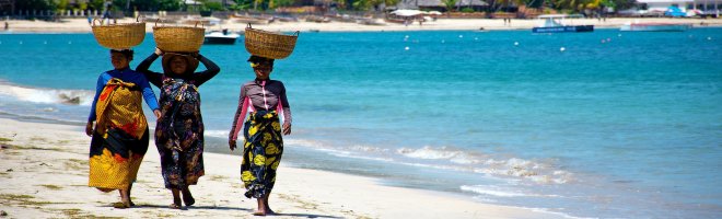
 If visiting Madagascar there are plenty of places of interest to see. Just under 13 miles from the capital is Ambohimanga with its royal city and burial site. Ambohimanga is perhaps the most important historical and spiritual site for the people of Madagascar despite much of it being destroyed by French colonialists towards the end of the nineteenth century. Nevertheless, it remains a place of worship and pilgrimage to this day with a traditional design representing the social and political structure of Malagasy society from at least the 16th century. If visiting Madagascar there are plenty of places of interest to see. Just under 13 miles from the capital is Ambohimanga with its royal city and burial site. Ambohimanga is perhaps the most important historical and spiritual site for the people of Madagascar despite much of it being destroyed by French colonialists towards the end of the nineteenth century. Nevertheless, it remains a place of worship and pilgrimage to this day with a traditional design representing the social and political structure of Malagasy society from at least the 16th century.
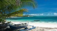
For those who simply want to relax, Mananjary on the east where the Mananjary River flows into the Indian Ocean is a popular resort, although best for sunbathing rather than swimming due to its waters being shark infested. The Tsingy de Bemaraha Strict Nature Reserve, 37 miles inland off the west coast of Madagascar, is also worth putting on your list of images to see. The area, established as a nature reserve in 1927, and currently a UNESCO World Heritage site since 1990 has an abundance of wild bird and a vibrant lemur population as well as being the location of ancient cemeteries. In the south-west of Madagscar is the popular Arboretum d'Antsokay which specialises in the flora and fauna of the area with around 900 species of plants as well as animals such as chameleons, boas, tenrecs and mouse lemurs; many of who cannot be seen anywhere else in the world. |