Eritrea Images
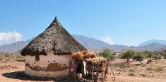 Although once regarded as a good tourist destination, today
very few outsiders get to see images of Eritrea as the country
is considered somewhat dangerous given the ongoing conflict with
its neighbour and former annexor Ethiopia.
It is also considered to be one of the most secretive countries
in Africa, having been described as the North Korea of Africa. This video is
therefore one of the rare opportunities to see
images of Eritrea, its land, its wildlife and its people and
where they live. Although once regarded as a good tourist destination, today
very few outsiders get to see images of Eritrea as the country
is considered somewhat dangerous given the ongoing conflict with
its neighbour and former annexor Ethiopia.
It is also considered to be one of the most secretive countries
in Africa, having been described as the North Korea of Africa. This video is
therefore one of the rare opportunities to see
images of Eritrea, its land, its wildlife and its people and
where they live.
Eritrea itself is bordered by the Red Sea to
the east, to the west and north-west by Sudan,
to the south by Ethiopia, and
to the south-east by Djibouti.
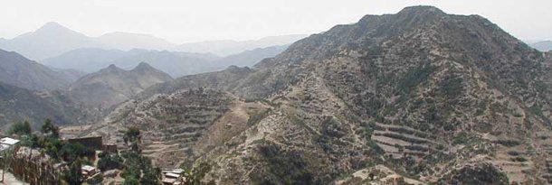
Eritrea is mainly located in hilly regions surrounded by the
craggy Emba Soira mountains and the country is home to the arid
Danakil Depression, however in the centre of the country there
is a fertile plateau.
 Eritrea has four main rivers; the Anseba, Gash, Barka and
Tekeze and has deposits of gold, zinc and copper underground
together with the possibility of oil and natural gas. Frequently
plagued by locust swarms and droughts that affect all countries
in and around the Horn of Africa, Eritrea has less than 5% of
arable land and one historically active volcano, Dubbi. Eritrea has four main rivers; the Anseba, Gash, Barka and
Tekeze and has deposits of gold, zinc and copper underground
together with the possibility of oil and natural gas. Frequently
plagued by locust swarms and droughts that affect all countries
in and around the Horn of Africa, Eritrea has less than 5% of
arable land and one historically active volcano, Dubbi.
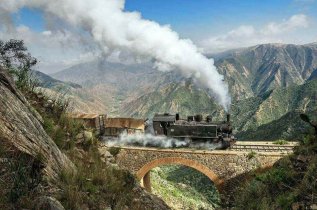
For those who do travel to Eritrea there are
many places worth a look, from the century old Italian built
Eritrean Railway (above) that runs from Asmara
(situated at 7,874 feet ~ the peak of Ben Nevis is just 4409 feet above sea level by comparison) to the city port of Massawa, prehistoric cave paintings in Qo Haito, Himbirti and
Hashimile, the ruins of the ancient Adulite empire in Qo
Haito and Metera and, of course, the coral reefs around 350
islands off the Red Sea coast including the Dahlak Archipelago. The video above provides images of Eritrea, its people,
landscape and wildlife and provides a useful insight into
Eritrea.
|
 Although once regarded as a good tourist destination, today
very few outsiders get to see images of Eritrea as the country
is considered somewhat dangerous given the ongoing conflict with
its neighbour and former annexor Ethiopia.
It is also considered to be one of the most secretive countries
in Africa, having been described as the North Korea of Africa. This video is
therefore one of the rare opportunities to see
images of Eritrea, its land, its wildlife and its people and
where they live.
  Eritrea has four main rivers; the Anseba, Gash, Barka and
Tekeze and has deposits of gold, zinc and copper underground
together with the possibility of oil and natural gas. Frequently
plagued by locust swarms and droughts that affect all countries
in and around the Horn of Africa, Eritrea has less than 5% of
arable land and one historically active volcano, Dubbi.